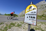
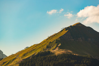
Col de la Colombière from the south


Contact
74450
Le Grand-Bornand
The Col de la Colombière has featured in the Tour de France 20 times since 1960. It’s southern side, above the resort of the Grand-Bornand, is much less formidable than the climb from Scionzier.
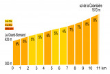
Gradient: 6.5%
Gradient: 6.5%
From 08/06 to 31/10.
Description
- SITRA services :
- Route Aller / Itinerance
- 690 Route
- 10.5 Distance (km)
- Levels of sporting experience :
- Level black - very hard
Localisation
FICHE_INFO_SIMPLE_LIBELLE_DESTINATION
74450
Le Grand-Bornand
GPS coordinates
Latitude : 45.94175
Longitude : 6.429126
Tarifs
Free access.
Download
View also
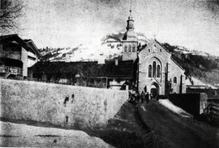
After 60 years of building work, undertaken and financed by the local community,it was consecrated in 1877. Built in the neo-gothic style of the XIX century, the architecture is typical of the golden age of the Catholic church.
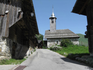
Founded in 1677, the chapel is nestled in the heart of the old village of Le Chinaillon. Despite major renovation work to the building in 1977, it has retained its traditional appearance.

04 50 02 78 00
Website
Located at 1618 m altitude, open from June to October, it connects Le Grand-Bornand in the Arve valley. Starting point for hikes, it is also a classic cycle route used many times by the Tour de France.
04 50 02 78 00
Website
Highest point of the winter ski area over 2000 m altitude, it's also a well-known take-off point for paragliders.