Hike to the Pointe-Percée Hut
Contact
Départ au Col des Annes
Vallée du Bouchet
74450
Le Grand-Bornand
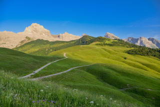
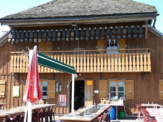
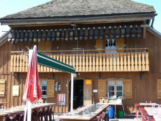
The Gramusset Hut is located right beneath the Point Percée, the high point of the Aravis Mountains (2750m). Start from Col des Annes Pass, which is surrounded by alpine pastures and is the birthplace of the area's famous farmhouse Reblochon cheese.
Trailhead: Col des Annes Pass.
Starting elevation: 1721m
Maximum elevation: 2164m
Roundtrip out and back.
Difficulty: difficult
Starting elevation: 1721m
Maximum elevation: 2164m
Roundtrip out and back.
Difficulty: difficult
Adopt a natural attitude throughout your walk:
Before setting off:
-Find out about the weather conditions. In the mountains, the weather changes quickly, so be prepared for heat, rain, wind and fatigue,
- Don't forget to take water with you,
- tell someone about the route you are taking.
During your hike :
-respect the paths, do not cut outside them,
- do not frighten livestock, do not cut wires and close fences,
- Observe wildlife from a distance,
- Nature is not a dustbin, so keep your rubbish and dispose of it in the containers provided in the villages,
- don't overestimate your abilities, some routes require good physical and technical skills.
On your return :
- Keep hydrated,
- Let us know if you have any comments.
From spring to fall, depending on snow conditions; you are responsible for your own safety. Look online or call for information on conditions.
In summary
- Reception :
- English
- SITRA services :
- Services
Description
- SITRA services :
- Route Aller / Retour
- Route
- 538 Route
- 7.4 Distance (km)
- Levels of sporting experience :
- Level red
- Pedestrian sports :
- Hiking itinerary
- Pedestrian sports
To note
- Type of SITRA offer :
- Not recommended in bad weather
Localisation
FICHE_INFO_SIMPLE_LIBELLE_DESTINATION
Départ au Col des Annes
Vallée du Bouchet
74450
Le Grand-Bornand
GPS coordinates
Latitude : 45.970481
Longitude : 6.524377
Information available at the Tourism Office or refer to the maps and/or guidebooks to locate the various hikes.
Tarifs
Free
View also
04 50 02 78 00
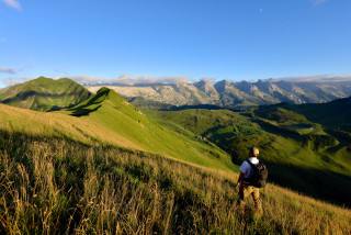
This route allows you to visit some of the Aravis’ traditional mountain chalets, some of which are still used to make cheese. The path goes through lush meadows surrounded by magnificent scenery. A cow’s life can’t be all bad!
04 50 02 78 00
Website
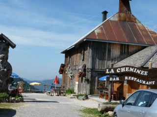
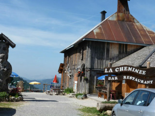
At an altitude of 1720 m, at the foot of the Pointe Percee (2750m), the highest peak in the Aravis range, with several mountain restaurants and summer farms whose architecture is unique in the department, and an unbeatable view of the Aravis mountains.
04 50 27 03 87
Fireplace, panoramic view on the Col des Annes.
04 58 17 05 98
Website
Located on the Tournette - Aravis circuit and based on its sea of lapies, offers a stunning view of the Aravis moutains and the Mont Blanc, by the Verts pass. Enjoy the sunshine and fresh mountain nights.
04 50 27 03 87
Savoyard specialities. Triangular fireplace, panoramic view from the col des Annes.
04 50 27 00 74
Restaurant located at the bottom of la pointe Percee, at the col des Annes. In a typical and family surroundings.
04 50 27 00 74
Bar located at the bottom of La Pointe Percee, at the col des Annes. In a typical and family surroundings.
04 58 17 05 98
06 37 67 22 62
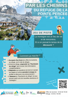
Observe what surrounds you when you go to the mountains via a refuge, take the time to go and meet this environment.


