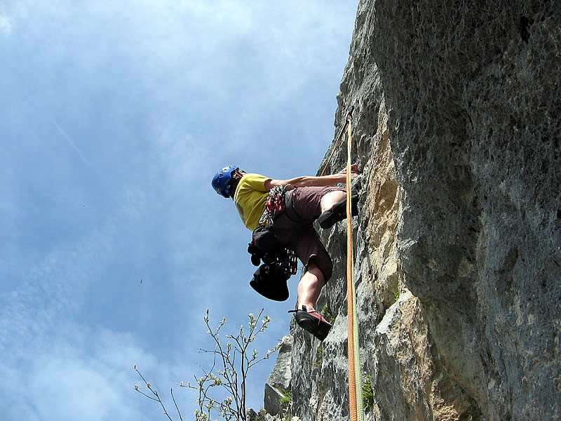
Rock climbing: multi-ptich route up the Piliers de la Pointe du Midi or Pointe Dzerat
Contact
Mairie du Grand-Bornand
Phone : +33 4 50 02 78 20
Contact
Col de la Colombière
Massif Bornes Aravis
74450
Le Grand-Bornand
Pointe du Midi's multiple pillars form a superb and amazing cliff band 250 m high. Climbing of moderate difficulty.
Altitude: 1900 m (base of route)
Height of routes: 250 m
Number of routes: 10
Route rating/difficulty: 3c: 2, 4a: 4, 4b: 4, 5c: 7, 5a: 6, 5b: 7, 5c: 19, 6a: 10, 6b: 3, 6c: 2, 7a: 1
Type of rock: limestone
Aspect: southeast facing,
Approach: 1 hour
To consider:
All routes are bolted with 12 mm bolts.
Bring 50 m double ropes, 12 quickdraws, a helmet, and good approach shoes.
Topo: information from the Aravis guidebook (28 climbing areas, 600 routes, 1400 pitches), which you can purchase through the Compagnie des Guides des Aravis (Aravis guide service) - www.compagnie-guides-aravis.com
From spring to autumn, depending on snow and weather conditions. Inquire about conditions before heading out. You are responsible for your own safety.
In summary
- Reception :
- French
- English
Description
- Climbing sports :
- Climbing sports
- Rock climbing site
Facilities and services
- Parking :
- Parking
Localisation
FICHE_INFO_SIMPLE_LIBELLE_DESTINATION
Col de la Colombière
Massif Bornes Aravis
74450
Le Grand-Bornand
GPS coordinates
Latitude : 46.002507
Longitude : 6.480474
Ask for information at the Tourism Office or refer to the guidebook to locate the different climbing areas.
Park at Col de la Colombière pass. Follow the trail that leads to the Grottes de Montarquis ("Grotte" means "Cave"). 600 to 700 meters after the Colombière farms, just prior to reaching a large boulder, head left on to a another trail (you will see a sign that reads "Voies d'escalade," which translates to "climbing routes") that at first parallels the prior trail, then heads up a small gully, over a small rock slide, leading you to a small pass. From there continue towards a yellow colored cliff band. Go around this cliff band to the right by heading up a couloir that's located just behind a tree growing right next to a large boulder. Average approach time: 1 hour from Col de la Colombière pass. A somewhat strenuous approach that requires good footwear and a healthy dose of caution.
Park at Col de la Colombière pass. Follow the trail that leads to the Grottes de Montarquis ("Grotte" means "Cave"). 600 to 700 meters after the Colombière farms, just prior to reaching a large boulder, head left on to a another trail (you will see a sign that reads "Voies d'escalade," which translates to "climbing routes") that at first parallels the prior trail, then heads up a small gully, over a small rock slide, leading you to a small pass. From there continue towards a yellow colored cliff band. Go around this cliff band to the right by heading up a couloir that's located just behind a tree growing right next to a large boulder. Average approach time: 1 hour from Col de la Colombière pass. A somewhat strenuous approach that requires good footwear and a healthy dose of caution.
Tarifs
Free

