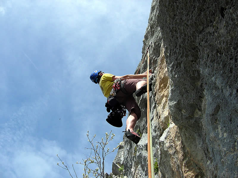
Rock climbing: multi-ptich route up the Pointe Percée
Contact
Mairie du Grand-Bornand
Phone : +33 4 50 02 78 20
Contact
En altitude
74450
Le Grand-Bornand
The North Arete is one of the most spectacular climbs of the Prealps. The Pointe Percée is the highest point of the Aravis Mountains. Literally meaning "pierced point," due to the small arch on the North Arete.
Altitude: 2200 m -2400 m (base of routes)
Height: 200-350 m
Number of routes: 30
Route rating/difficulty: 3b: 3, 3c: 3, 4a: 2, 4b: 11, 4c: 5, 5a: 4, 5b: 14, 5c: 21, 6a: 17, 6b: 18, 6c: 15, 7a: 10, 7b: 2
Type of rock: limestone
Aspect: north facing and west facing depending on route.
Approach: 1.5-2 hours
To consider:
Frequent afternoon thunderstorms in the summer. Retreat is difficult for routes on the north face.
Bring 50 m double ropes, 12 quickdraws, a helmet...
Topo: information from the Aravis guidebook (28 climbing areas, 600 routes, 1400 pitches), which you can purchase through the Compagnie des Guides des Aravis (Aravis guide service) - www.compagnie-guides-aravis.com
From spring to autumn, depending on snow and weather conditions. Inquire about conditions before heading out. You are responsible for your own safety.
In summary
- Reception :
- French
- English
Description
- Climbing sports :
- Climbing sports
- Rock climbing site
Localisation
FICHE_INFO_SIMPLE_LIBELLE_DESTINATION
En altitude
74450
Le Grand-Bornand
GPS coordinates
Latitude : 45.955834
Longitude : 6.556478
Ask for information at the Tourism Office or refer to the guidebook to locate the different climbing areas.
From Le Grand-Bornand Village, take the road that leads to the Bouchet Valley, and after approximately 4 km, turn left onto the road that leads to Col des Annes pass. Go all the way to the end of the road and park there. Follow the well traveled and marked trail to the Gramusset hut (1 to 1.5 hours).
- For routes on the Paroi de Gramusset: from the hut, head directly towards the steep, 200 m high cliff easily visible from the hut. The approach trail was entirely renovated in 1994.
-For the North Arete and other routes on the north face: from the hut follow the trail for the regular hikers' route, then 100 m before reaching the north face, traverse left along the base, then up the limestone pavement and scree until you reach the start of the North Arete.
Tarifs
Free

